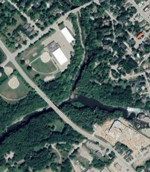
Today me and the rest of my ENVS*2240 Environmental Geology class embarked on a day long field trip spanning from the western end of the Niagara Escarpment in Hamilton to the Elora Gorge. There was 8 stops in total that walked us through the geologic history of the area and as it’s the blogs 1 year anniversary, I thought it would be fun to make a blog post of it 🙂
STOP 1: The Devil’s Punchbowl Conservation Area, Hamilton
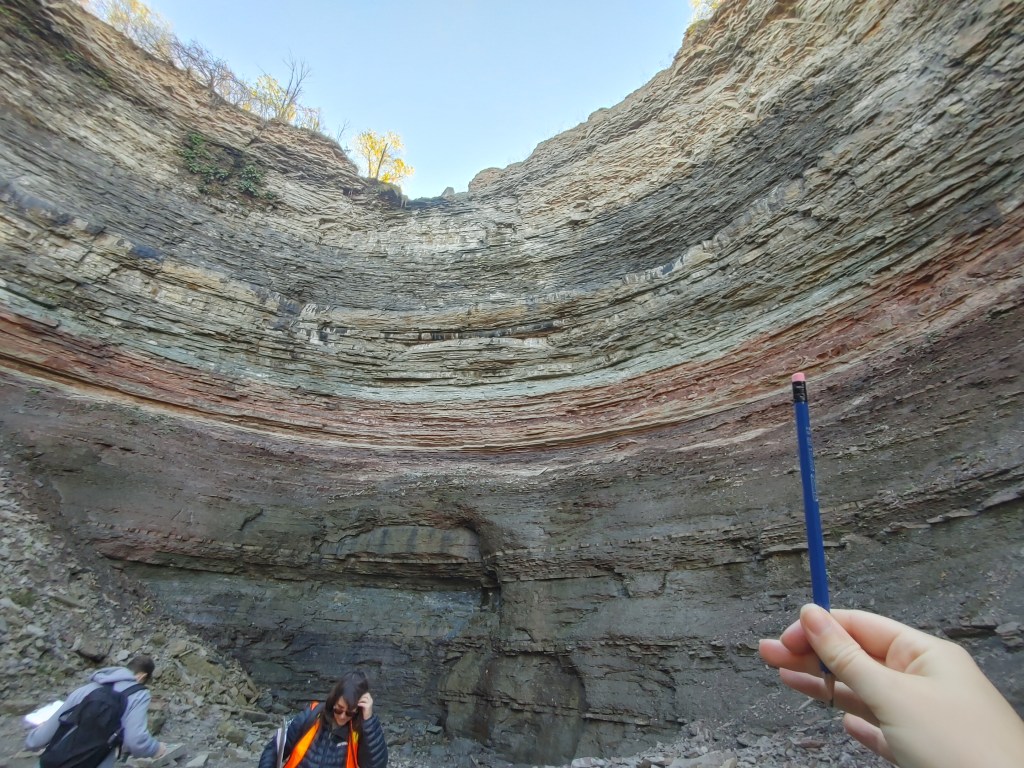
Hidden away at the top of a large ridge in the satellite community of Stony Creek is a massive outcrop of Canadian geologic history in the shape of a bowl digs ~80m into the layers of rock of the Niagara Escarpment. Usually, there is a water fall that pours over the centre point of the bowl (you can see a little indent at the top where the water has begun to erode the rock away), however, we were visiting when most of the waterfalls have dried up.
The Niagara Escarpment actually begins at the south shore of Lake Ontario, arcs over Lake Huron, and borders Lake Michigan into Wisconsin. Of course the escarpment is most famous for the cliffs that the waters of the Niagara River will plunge over at the border, but it also displays some truly fascinating geologic history that is maybe less picturesque, but interesting all the same. If the escarpment that displays this history was created by thousands of years of stream erosion even before the glaciers were around, and then molded out by said glaciers, what formed the distinct layers of rock?
Well…it’s time for a brief history of about 450 million years.
Somewhere 450 million years ago in the late Ordovician period when North American was known as Laurentia and Pangea wouldn’t form for another 150 million years, we were more or less underwater in a shallow reef-bearing sea. This sea was full of all those alien looking sea creatures like our well-known corals, and lesser known brachiopods and trilobites that we see in old fossils from this time period. At this point in history, the eastern part of Laurentia (where our backyard would lie) rested on a plate boundary of tectonic plates. A belt of volcanic islands (an arc) collided with the continental plate of eastern Laurentia and created what geologists call, ‘a Taconic Orogeny’ or a mountain building episode. This collision would begin the formation of the Appalachian Mountains. Generally, where there is a natural elevation, there is also a natural depression – a basin. As these mountains rose, streams flowing west towards where Toronto would be located deposited the first layer of rock that would form the base layer of the escarpment – the Queenston Shale Delta into the now formed Appalachian basin.
Throughout the early Silurian period (~440mya), lots of mud from river deltas and shallow-marine environments, sand, and limestone that had lost some of its carbonate composition to become dolomitic were deposited on top of the Queenston Shale. The Cabot and Manitoulin formations are identified by the large amounts of mud located at the bottom of the punchbowl. On top of the muddier layers lie layers of mostly red sandstone until we reach the middle Silurian period (~425mya).
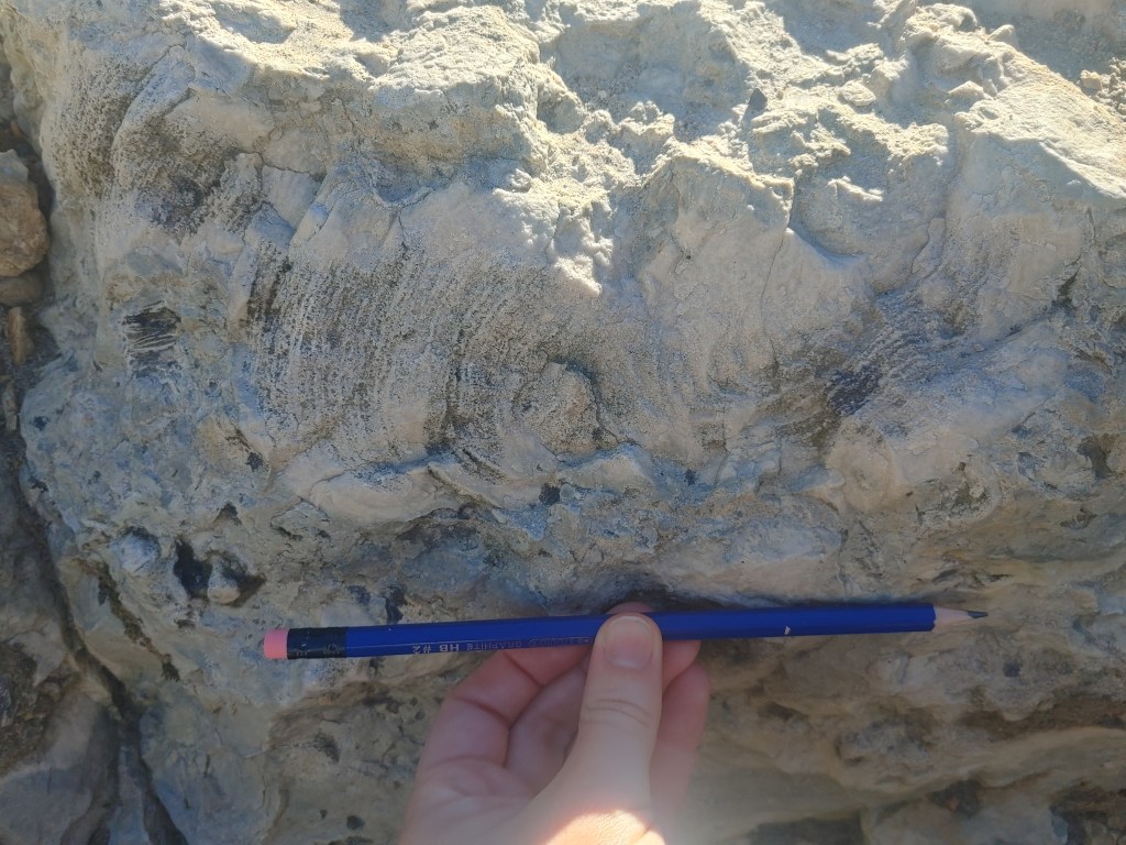
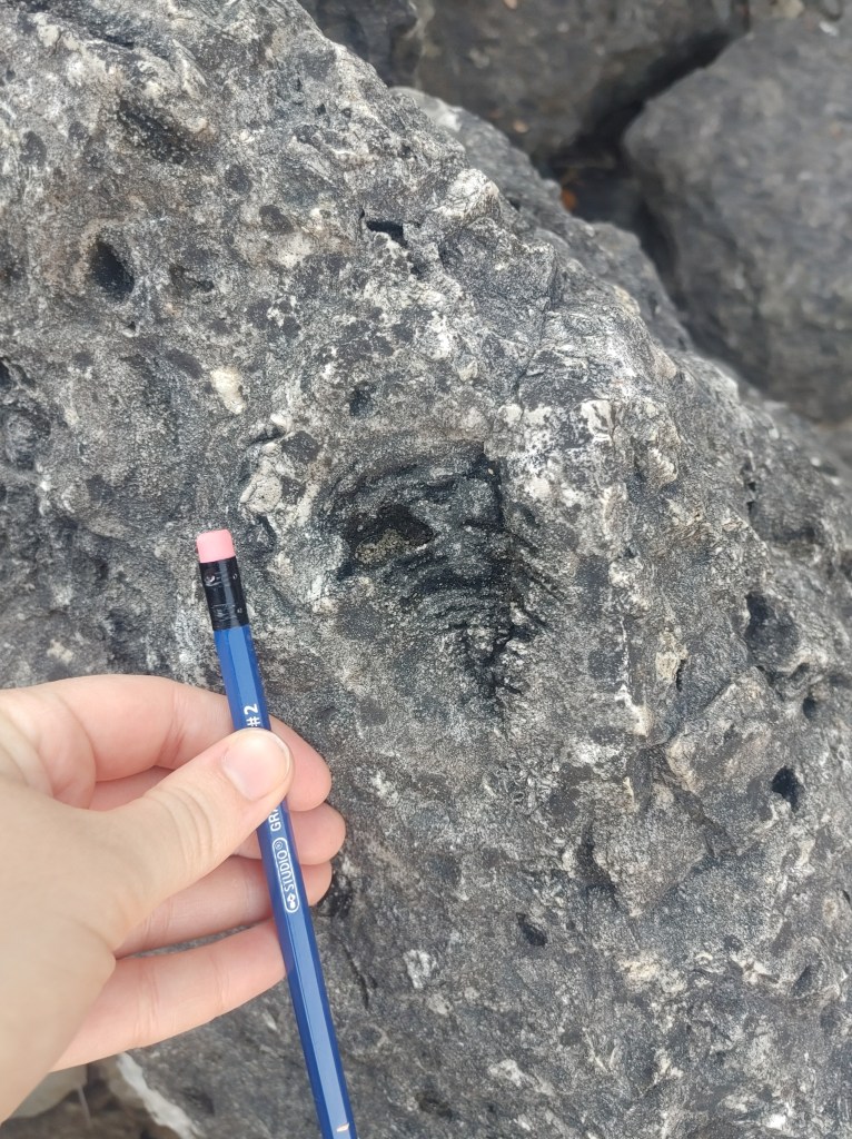
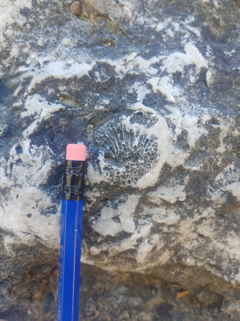
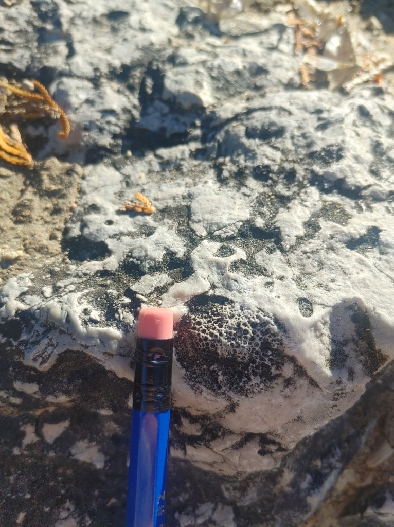
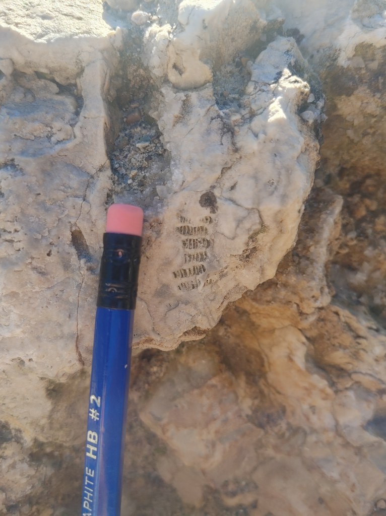
The Michigan Basin is also another important basin that was formed through natural sinking of the Earth, to which is commonly flooded into a shallow sea and marks a distinct return to the shallow reef-bearing sea and carbonate layers of rock. Carbonate in sedimentary rocks are most often caused by the present of fossils as many sea creatures have carbonate in their shells and structures which we can see is present in the layers above the red and greeny layers of the punchbowl. Littering the floor of the lower punchbowl waterfall are hundreds of broken fragments of rock holding all types of fun surprises.
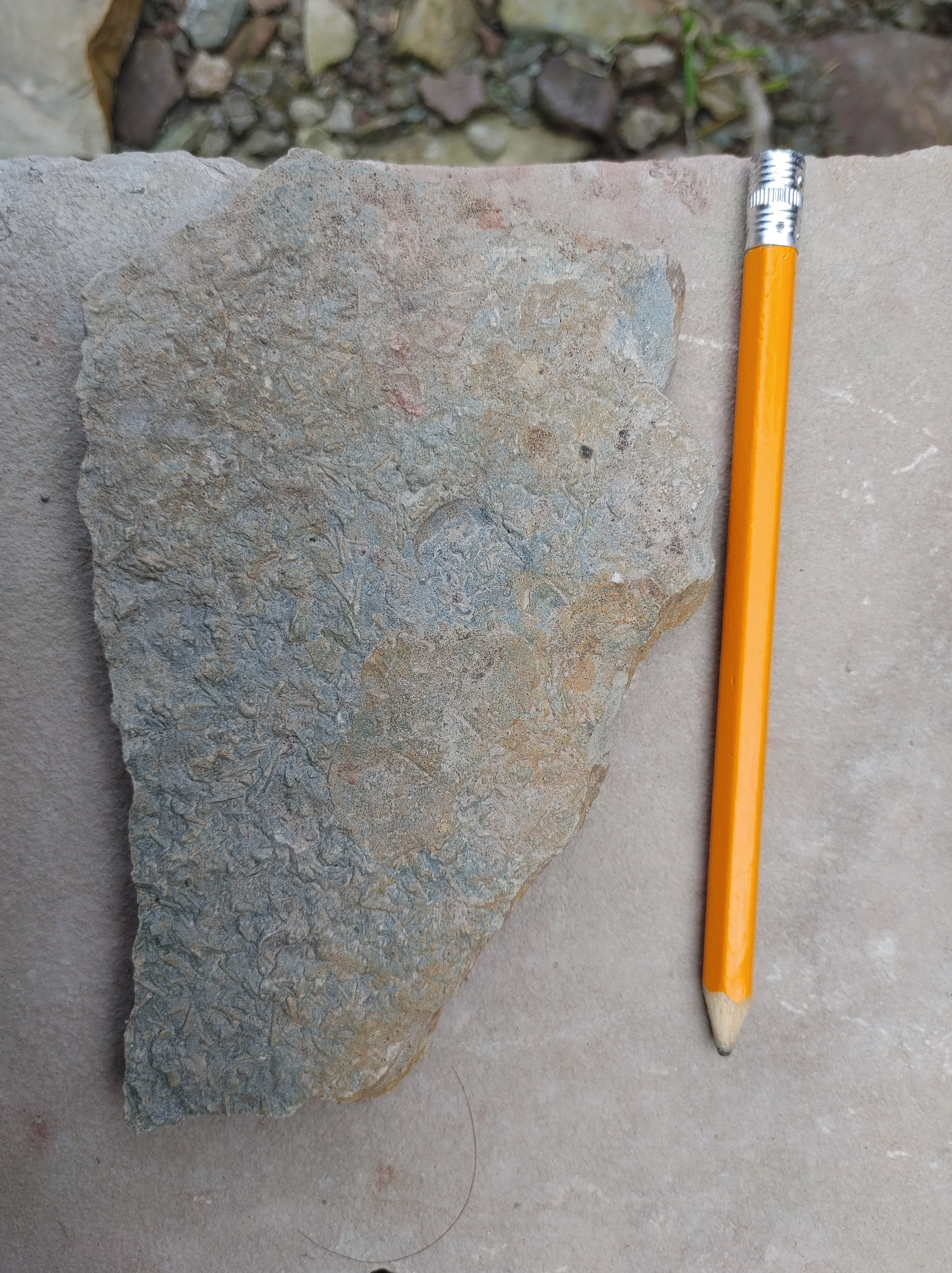
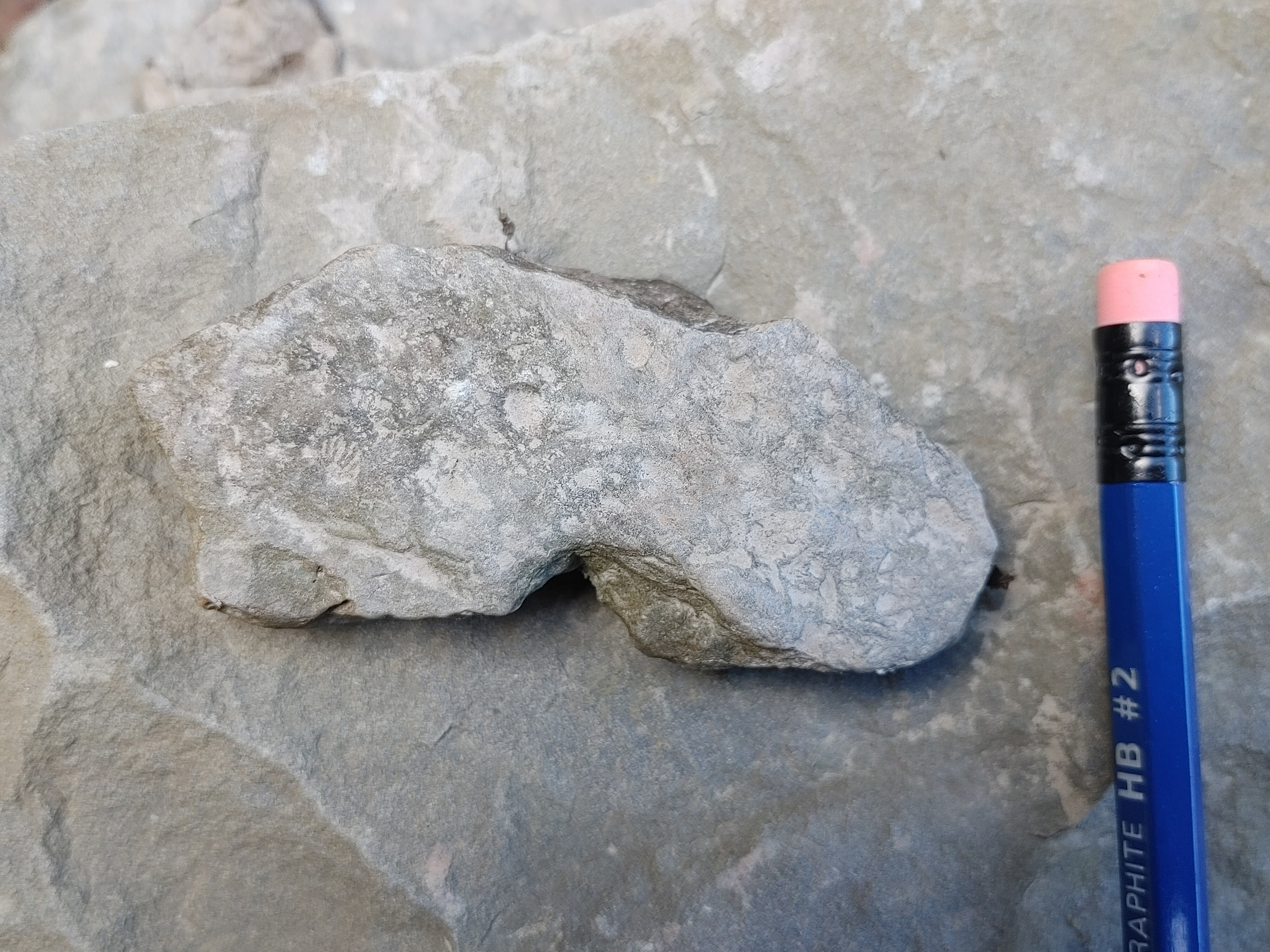
I found a really cool fossil plate of a rock (leftmost) with a collection of different tiny fossils, as well as a smaller version (bottom right) with more small fossils from this ancient shallow reef. The top right is actually a rock with what we call ‘ripple marks’. As waves move across sediment and that sediment slowly compacts into sediment rocks, it sometimes keep the shape of how the waves of the water current affected the sediment. This tell us a lot about the body of water this rock came from and whether the current was symmetrical such as the rocking of a sea, or the unidirectional current of a running river. In this case, they were symmetrical ripples, characteristic of a shallow sea! It was way easier to see the dimensions of the ripples in person.
The middle Silurian also created the upper layers of the punchbowl. But hey, if this is all sedimentary rock, susceptible to erosion, how is it still standing while exposed to the elements?
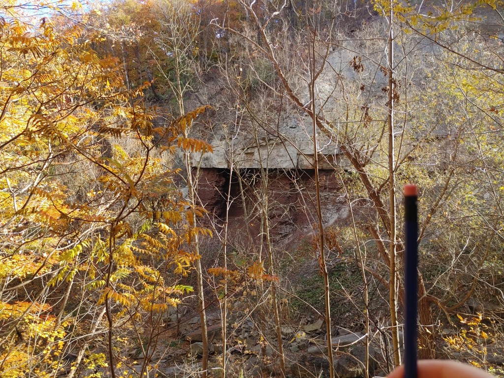
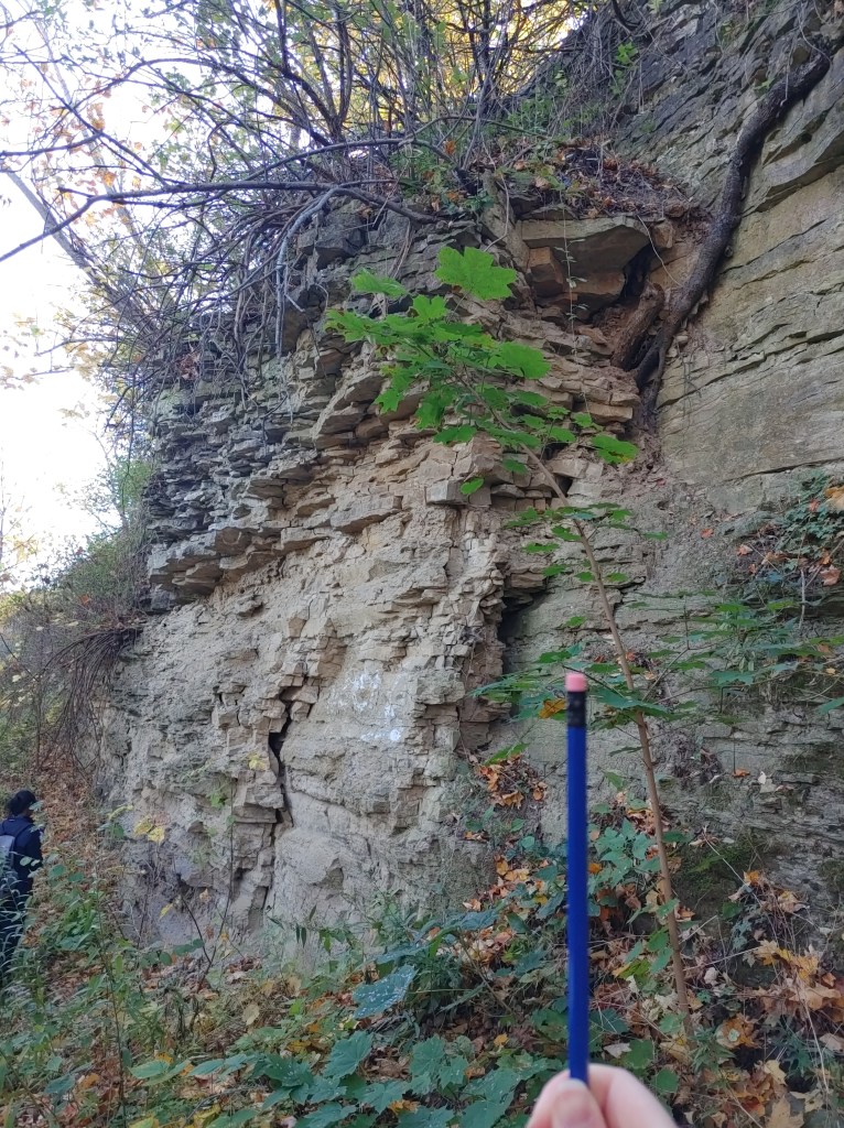
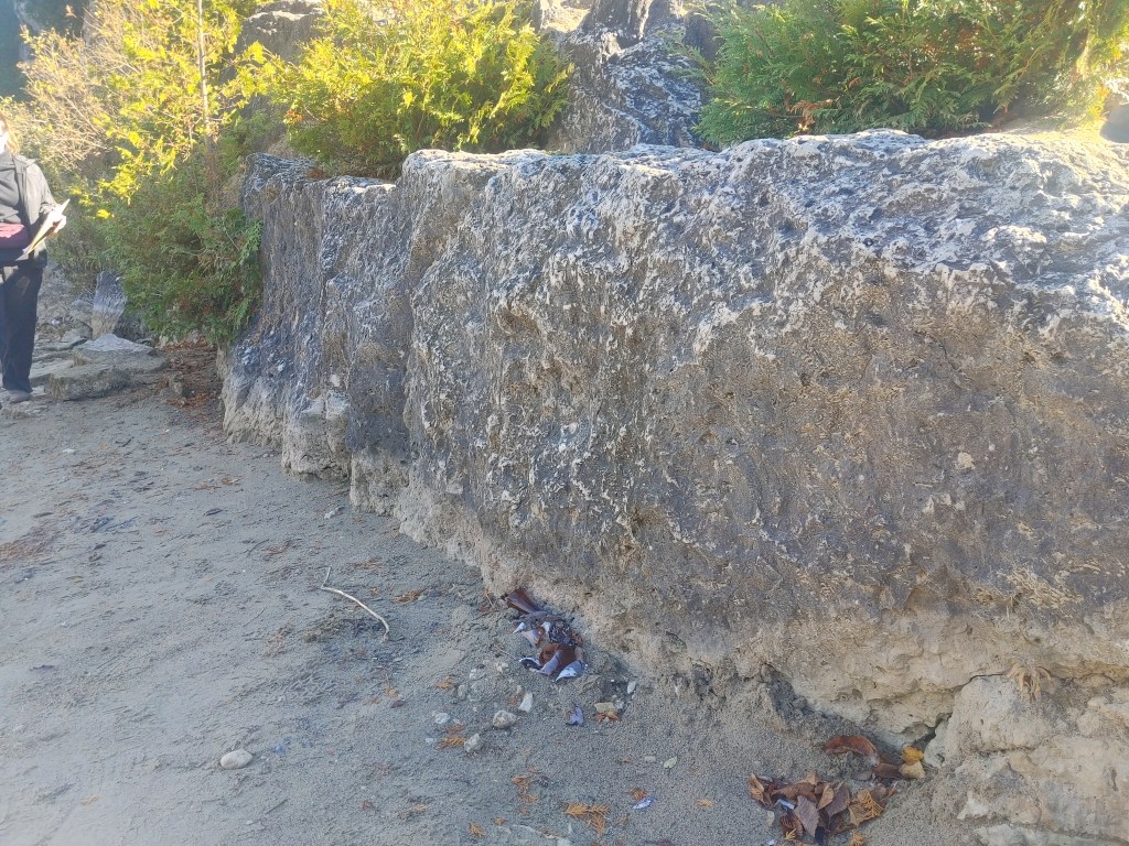
Towards the middle and late Silurian when all of that marine sediment was deposited from the shallow seas, it contained a lot of calcium carbonate! Aka the building blocks to the very well known rock and very common rock in Ontario – Limestone! Over time, more magnesium rich waters began to chemically alter the limestone to become dolostone – a harder, darker, more resistant version of limestone. Dolostone is pretty resistant to erosion and weathering meaning it is the perfect capstone, or hat, for the rest of these more fragile sedimentary rocks to have protecting them. The dolostone capstone is well seen in the overhang in the first picture, and in the second picture as the colour and blockiness between the lower shale and upper dolostone. This capstone is the only reason the amazing landscape of the Niagara Escarpment has been preserved for millions of years from the Silurian time period all the way to our current Holocene 430mya later.
Of course this dolostone capstone does have its limits as the escarpment is only visible from millions of years of weathering and erosion from waterways before the glaciers where the water was able to erode the softer layers and continue through the sediment layers until it looks like what it looks like now. While the glaciers did have a part to play, it did not create this landform unlike how drastically the rest of Ontario has been shaped by them, which we will see later.
I swear the rest of the stops will be much shorter than this one! This one was laying down the geologic history that explains why the landscapes of southwestern Ontario look the way they do.
STOP 2: An Ancient Reef Right Next to the 401
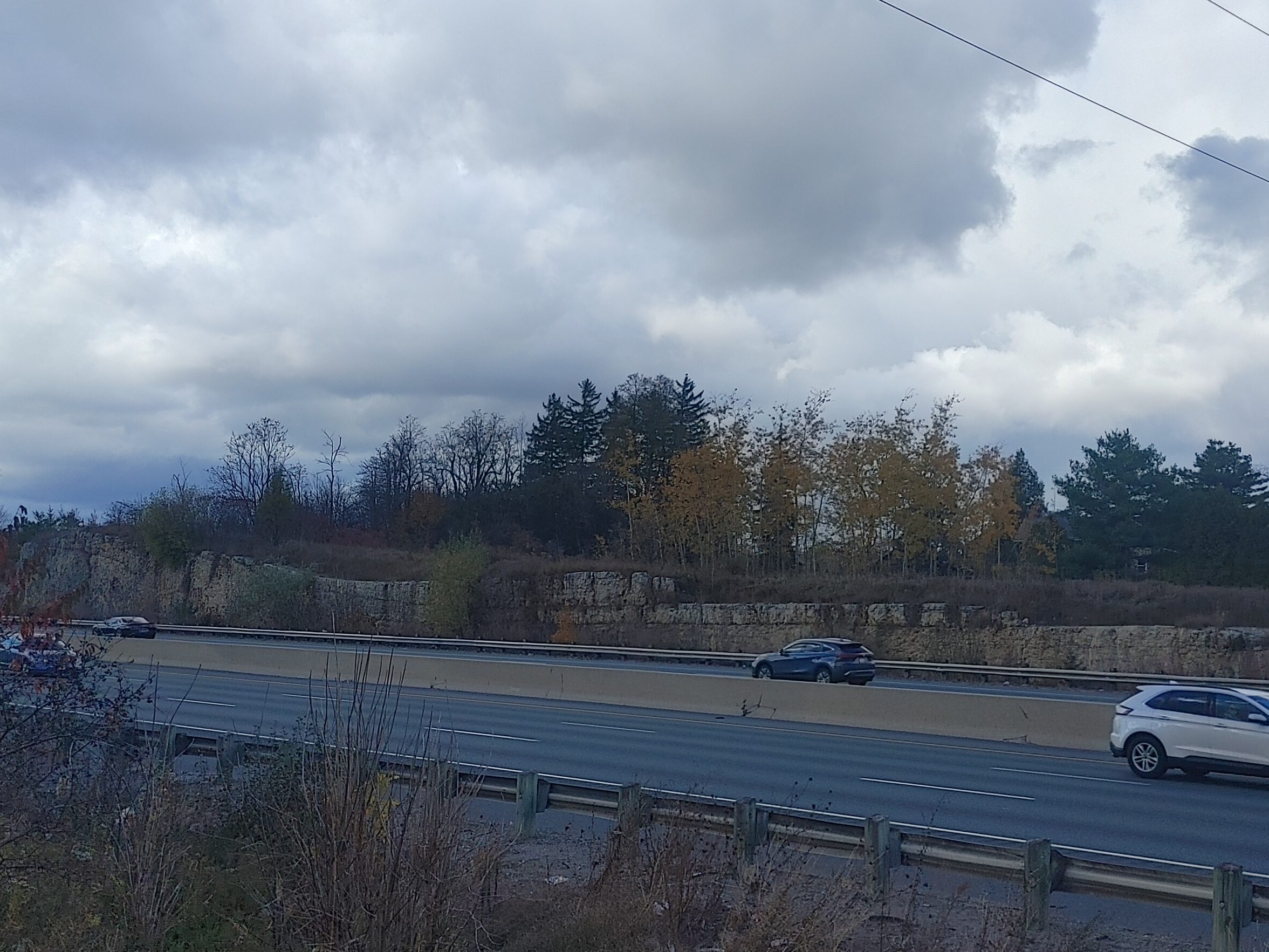
On the 401 heading towards Aberfoyle from Campbellville lies an ancient artefact packed with fossils in plain sight. I always thought those rocks were somehow placed there, but I guess I never looked at it too closely.
These rocks are apart of the Silurian reefs present in the middle Silurian period composed mostly of dolostone. The glaciers, when they glaciated the area (14,000 ya) smoothed out this outcrop and you can see it’s path from right to left as it slowly builds in elevation as the glaciers moved across right to left, remolding the structure of this reef formation.
STOP 3 AND 4: The Paris Moraine and Flat Plains
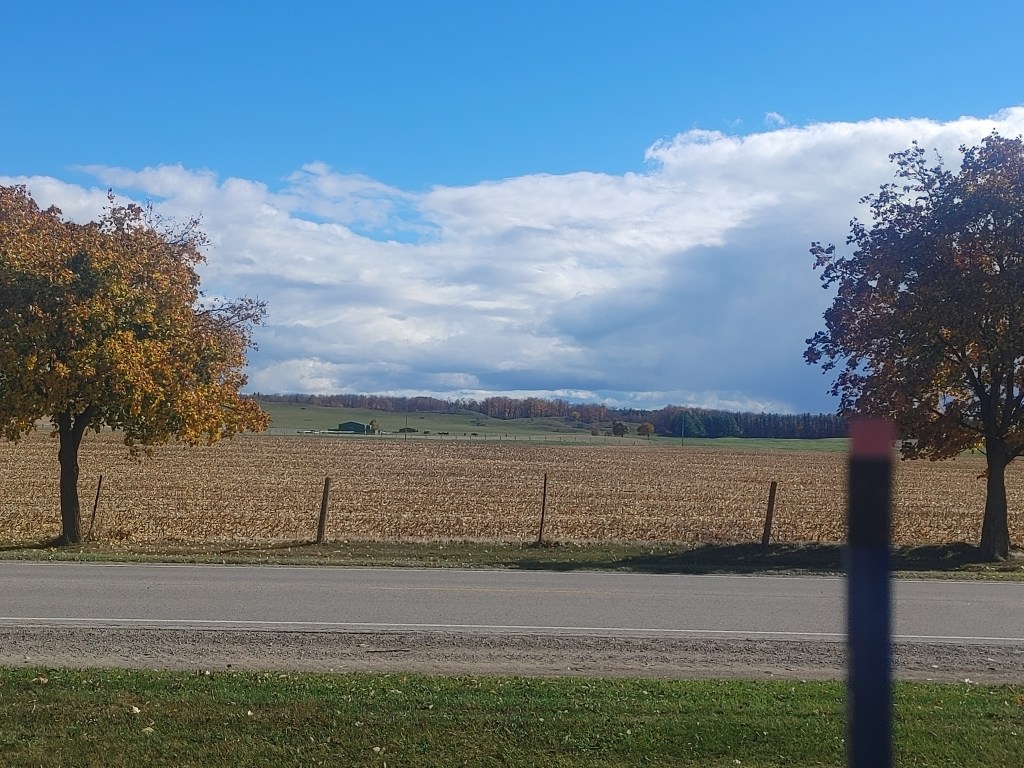
When glaciers move sediment, they tend to dump it in unorganized clusters of whatever happened to be around at the time unlike water current which tends to organize sediment by size due to density. When these dump of sediment let time pass, we see the grassy, rolling hummocky hills of southern Ontario also known as moraines! Moraines are essentially the transported deposited bunches of sediments by glaciers (just as deltas are the same things but for currents of water). The moraines at the back of this photo are classified as The Paris Moraines.
How do we figure out where a moraine ends? Well…the leftover outwash plain that is left behind when the glaciers melt/move on, and water is left to do all the work. In front of the Paris Moraine in this photo is a flat expanse of land (a flat plain) that is known as an outwash. Here, sediment is carried and organized by the streams running off the glaciers. This is also why this area of Ontario is so nutrient rich and perfect for agriculture.
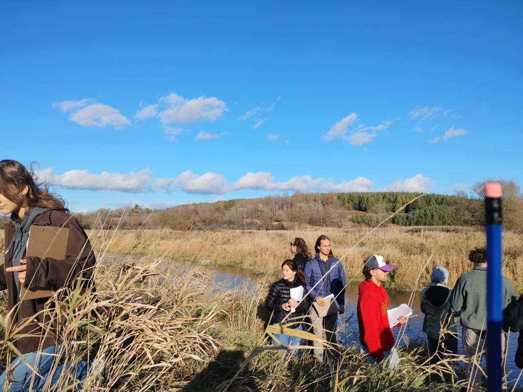
STOP 5: Elora Quarry Conservation Area
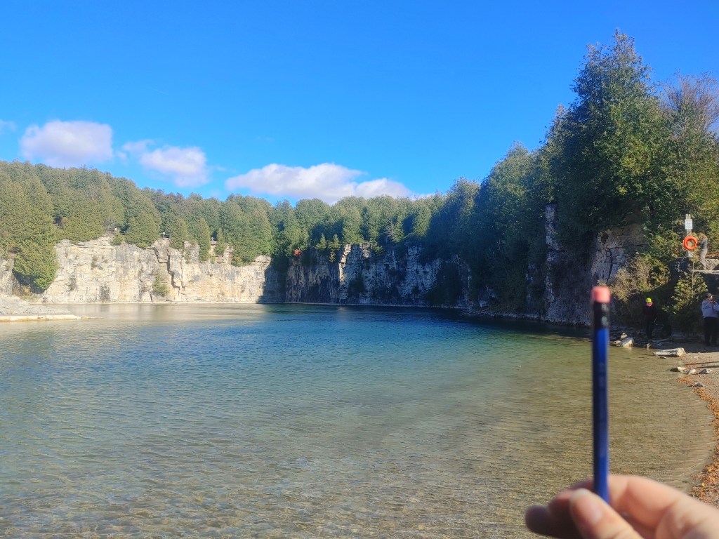
The Elora Quarry conservation area used to be a bedrock quarry on the bank of the Grand River and displays the Guelph Formation of the middle Silurian (430mya) that is rich in dolomites (dolostone rocks), and apart of the Michigan Basin. Again, this area in the middle Silurian was all a shallow inland sea full of fun ocean critters meaning one, exact thing… We have fossils, baby!
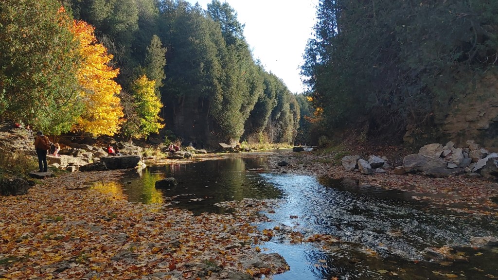
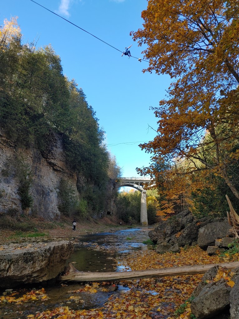
STOP 6: Elora Gorge
Here’s a fun question: Yes or No, was the Elora Gorge created by glaciers? The Devil’s Punchbowl certainly wasn’t!
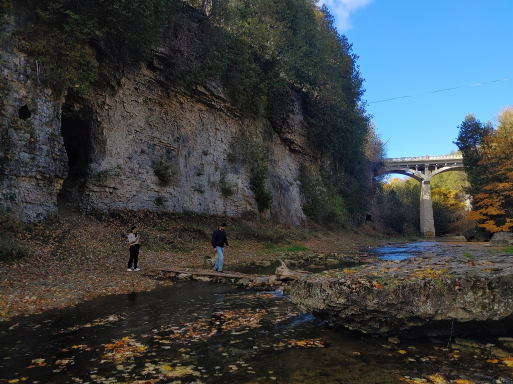
If you answered yes, despite my purposeful jab at your confidence in the creation of Canadian geological features, you’d be right! 14,000 years ago when we were covered by kilometers thick glaciers, the ice scraped and carved it’s way through whatever soil was already on-top of that hard dolostone layer of the Guelph Formation, leaving it exposed. Once the glaciers retreated, it had formed a whole new landscape of all exposed dolostone, glacial till, and drainage patterns for the beginnings of the Grand River fueled by meltwater and rain run off began to carve it’s way through the softer parts of the dolostone layer and whatever fractured areas there may have been before hitting softer under layers. Over thousands of years, the river grew in size as it carved out what we see today and still continues to carve!
But the Elora Gorge isn’t just a gorge where the Grand runs through. It has caves and islands and weird rapids and waterfalls that make this area so unique. Why?
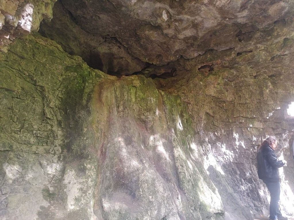
Did you know that if you squeeze out a drop of hydrochloric acid on a carbonate it will begin to fizzle and dissolve? This happens to dolostone as well, even if it is more resistant than its limestone counterpart. So what happens when slightly acidic rain run off runs off these dolostone structures over time? Karst structures! This chemical weathering of dolostone creates the unique caves, channels, and cracks typical of this area. We can see this exact weathering right underneath the cave in the picture where the rock is suddenly weirdly smooth right where you’d expect water to run off. In the first picture of the bridge, you can see two more caves and a hole in the rock face from this ‘karst erosion’ process.
The rapids and waterfalls of the gorge are also due to this resistant dolostone. Not all dolostone is created equally and some dolostone will be weaker than others, leading to some being eroded (leading to the creation of the gorge) and others to standing the test of time beneath the current, creating rapids and waterfalls. This is also the reason why the Devil’s Punchbowl is a waterfall area!
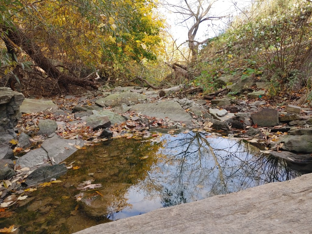
In this photo, we have the larger and faster moving Grand River running through the gorge, however, to the North we have the Irvine creek that seems to join the Grand River at a point we call a Confluence (where two rivers meet). The Irvine is slower moving than the Grand, so when these two bodies meet, the sediment that Irvine carries creates somewhat of a wall when hitting the current of the Grand. After time, this builds up and creates what we see in the first photo: a sediment island. There’s much more to how these islands form beyond just the confluence, but that’s above my paygrade.
STOP 7: Gravel Quarry
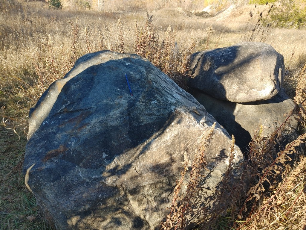
For a gravel quarry, these rocks look a little out of place. And you’d be right. These are igneous rocks, chunks of granite that have been carried a long way from home in the Canadian Shield.
When glaciers carry and deposit boulders into places that they aren’t known to be commonplace to be, it’s called ‘Glacial Erratic’. Honestly, this stop was pretty boring and the coolest thing to happen was the group finding a mysterious rodent skull which we all tried our shot at IDing. Nothing gets a bunch of enviro scis up and at ’em than a suspicious skull in a quarry field.
STOP 8: The Grand River Valley
Well this valley looks awful different than the Devil’s Punchbowl and the Elora Gorge. Well, the Wilson’s Flats in the Grand River Valley is a great example of the glaciers finally doing some work, instead of leaving all the work of erosion and formation to the water. We can describe the Elora Gorge as V-shaped due to the sharpness caused by the Grand River cutting through it, whereas the Grand River Valley can be described as U-shaped. It’s topography is much more gentle, and you can envision a giant glacier resting on top of this area, slowly moving and forming the area to be much more of a gradual depression that would eventually guide the formation of many river systems such as the Grand that would go onto create the Elora Gorge.
School has been crazy lately, and as the first wave of midterms dies down, the second wave is approaching on the horizon. I haven’t been able to allocate the time to really go on any adventures in the area like I wanted to especially since I did that quite often out west and found it really beneficial for me. So, being able to go on many small adventures, while also learning more about the environment around me is right up my alley. This geology field trip was a blast, and definitely reignited a curiosity that may have been suffocated by the quite industrial process of studying information to best regurgitate it on our test.
I had been also wanting to post a blog entry talking about some of the cool things I had learned in my classes recently as a way to keep the blog alive since I really enjoy writing entries, studying topics I find interesting, and sharing that to whoever is reading. But, I got busy and never got around to it. So, you can imagine my surprise when I opened wordpress to start the draft and saw that it had been exactly a year since I had created this site for Alert. I know it hasn’t been a year since my first official post, but I felt the coincidence was too strong as to not bust out a 3k post on rocks.
Btw clastics is basically rocks broken into fragments and is a term used to describe sedimentary rocks. I made a pun out of ‘The Classics’.

Leave a reply to jcarolsmith52 Cancel reply